Most know that modern Thatcham stems from the Saxons, many know there were people in the area before this so where were they if not in the modern town centre?

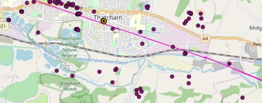
In the 20th century the theory that the Roman road of Ermin Way crossed the Kennet to the east of Colthrop and cut across Henwick Field to the west started to appear. However the exact route remains a mystery and this suggested route might not be the true route, there is a possibility it might be further south. There have been numerous findings in Thatcham, mostly around the Henwick to St Johns Road area. Those finds include wells, coins, pewter plates, tiles, leather shoes and pottery indicating a activity during the Roman period. A hearth was also discovered and along with other finds. The map (yellow shows St Mary’s Church) shows where some of the finds have been made (note some are approximate locations).
Perhaps one of the most interesting finds was that of the skeletons of a man and a horse close at Colthrop Mill. In the area of Chamberhouse Farm evidence from an excavation provides evidence of Iron Age and Roman field systems.
Many of the finds are recorded in archaeological excavations, however others are markers on OS maps, or stories in old books, all of which need to be verified -i.e. I don’t believe that all the finds of the road are actually the road, some are solitary ditches often with little dating evidence and others I have bigger issues with! There is also a lack of a cemetery, unlike Newbury which has a Roman cemetery but little else, and the exact course of Ermin Way through Thatcham is not clear.
I have no doubt that there was a settlement in Thatcham during the Roman period. The exact size and nature of the settlement remain uncertain. As to the road, did it go the proposed route as shown on the map, or did it go further south? What is needed is for a review checking all the sources, tracking down items and reevaluating, and analysing it all.
